


At ExtremeTerrain.com our goal is to provide you with the most accurate and reliable information for making decisions regarding the purchase of off-road and 4x4 parts. ExtremeTerrain.com can help you build your ultimate off-road vehicle with the dependable 4x4 performance items we offer. ExtremeTerrain.com has experienced offroad enthusiasts handle its customers' service inquiries. When you talk with one of our technical support staff you are speaking with a knowledgeable 4x4 enthusiast. We are passionate enthusiasts whose customers are the number one priority.
Show Vehicle Menu
Engine
Engine
Alternators & Starters
Batteries
Cold Air Intakes & Air Filters
Cooling System
Engine & Transmission Mounts
Engine Dressup
Fuel System
Gaskets, Seals & Filters
Heating & A/C Parts
Ignition
Internal Engine Parts
Nitrous Kits
Oil Catch Cans
Oil Pans & Parts
Oils & Fluids
Power Packages
Reservoir Tanks
Sensors & Sending Units
Snorkels
Supercharger Kits
Throttle Body Spacers
Throttle Enhancement
Tuners
Exterior
Exterior
Antennas
Bike Racks
Body Armor
Body Kits, Spoilers, & Trim
Bug Deflectors & Window Visors
Bumpers & Towing
Caliper Covers
Complete Styling Kits
Doors & Door Accessories
Fender Flares & Fenders
Fuel Doors & Gas Caps
Grille Inserts & Overlays
Hoods & Hood Accessories
Inner Fender
Lights
Mirrors
Mud Flaps & Guards
Offroad Storage & Tool Boxes
Rear Cargo Racks
Restoration Parts
Rock Sliders & Rocker Guards
Roll Bars & Cages
Roof Racks
Running Boards & Side Steps
Skid Plates
Snow Plows
Stickers & Vinyl Decals
Tire Covers
Tops & Accessories
Interior
Interior
Audio & CB Equipment
Carpeting & Flooring
Center Consoles
Floor Mats
Gauges
Grab Handles & Padding
Headliners
Interior Lighting
Interior Restoration
Interior Storage
Interior Trim
Navigation Systems
Rear Cargo Storage
Seat Covers
Seats & Hardware
Shift Knobs
Steering Wheel Covers & Steering Wheels
Sun Visors
Switches
Suspension
Suspension
Air Springs & Accessories
Brakes
Bump Stops
Bushings & Body Mounts
Coil Over Kits
Coil Spring Spacers
Coil Springs & Accessories
Control Arms & Accessories
Handling Kits
Leaf Springs & Accessories
Leveling Kits
Lift Kits
Long Arm Upgrade Kits
Shocks
Slip Yoke Eliminator Kits
Steering
Steering Stabilizers
Subframe Connectors & Braces
Sway Bars, Links & Disconnects
Tie Rods, Ends, & Ball Joints
Track Bars
Transfer Case Drops
Engine
Engine
Air, Oil, & Fuel Filters
Cold Air Intake & Tuner Kits
Cold Air Intakes
Engine & Transmission Mounts
Engine Components
Engine Cooling
Engine Dressup
Exhaust
Fuel System Parts
Gaskets & Seals
Ignition Parts
Mass Air Flow Meters
Nitrous Kits
Oil & Engine Fluids
Oil Catch Cans
Pulleys
Supercharger Kits & Accessories
Throttle Bodies & Accessories
Throttle Enhancement
Tuners
Turbocharger Kits & Accessories
Exterior
Exterior
Antennas
Armor & Skid Plates
Bed & Tailgate Steps
Bed Accessories
Bed Covers & Tonneau Covers
Bed Liners & Bed Mats
Bed Racks, Roof Racks & Carriers
Bed Rails & Caps
Bike Racks
Body & Frame Components
Body Kits & Spoilers
Brush Guards & Grille Guards
Bug Deflectors & Rain Guards
Bull Bars
Bumpers
Caliper Covers
Decals, Stripes & Graphics
Door Accessories
Doors
Emblems & Badges
Exterior Hardware
Exterior Trim
Fender Flares
Fuel Doors
Grilles
Hitch Covers
Hoods & Hood Struts
Inner Fender
Lights
Mirrors & Mirror Covers
Mud Flaps & Splash Guards
Onboard Air
Ramps
Rock Sliders
Roll Bars & Chase Racks
Scoops, Louvers, & Vents
Side Step Bars & Running Boards
Snow Plows
Storage & Tool Boxes
Tailgates & Accessories
Tire Carriers & Accessories
Tops
Towing & Hitches
Truck Covers & Bra
Weatherstripping
Wheels & Tires
Winches
Interior
Interior
Audio & Electronics
Center Consoles
Dash Overlay Kits
Door Sills
Floor Mats, Liners & Carpets
Gauges
Grab Handles
Interior Lights
Interior Trim
Pedals & Pedal Covers
Seat Covers
Seats & Hardware
Shift Knobs & Accessories
Steering Wheels & Accessories
Storage & Consoles
Sun Shade and Windshield Tint
Engine
Engine
Alternators & Starters
Batteries
Cold Air Intakes & Air Filters
Cooling System
Engine & Transmission Mounts
Engine Dressup
Fuel System Parts
Gaskets, Seals & Filters
Heating & A/C Parts
Ignition Parts
Internal Engine Parts
Oil & Engine Fluids
Oil Catch Cans
Oil Pans & Parts
Reservoir Tanks
Sensors & Sending Units
Supercharger Kits
Throttle Body Spacers
Throttle Enhancement
Tuners
Exterior
Exterior
Antennas
Bike Racks
Body Armor
Body Kits, Spoilers, & Trim
Bug Deflectors & Window Visors
Bumpers & Towing
Caliper Covers
Doors & Door Accessories
Fender Flares & Fenders
Fuel Doors & Gas Caps
Grille Inserts & Overlays
Hoods & Hood Accessories
Lights
Mirrors
Mud Flaps & Guards
Offroad Storage
Rear Cargo Racks
Restoration Parts
Rock Sliders & Rocker Guards
Roll Bars & Cages
Roof Racks
Running Boards & Side Steps
Skid Plates
Stickers & Vinyl Decals
Tire Covers
Tops & Accessories
Interior
Interior
Audio & CB Equipment
Carpeting & Flooring
Center Consoles
Floor Mats
Gauges
Grab Handles & Padding
Headliners
Interior Lighting
Interior Restoration
Interior Storage
Interior Trim
Navigation Systems
Rear Cargo Storage
Seat Covers
Seats & Hardware
Shift Knobs
Steering Wheel Covers & Steering Wheels
Sun Visors
Switches
Suspension
Suspension
Air Springs & Accessories
Brakes
Bump Stops
Bushings & Body Mounts
Coil Spring Spacers
Coil Springs & Accessories
Control Arms & Accessories
Leaf Springs & Accessories
Leveling Kits
Lift Kits
Long Arm Upgrade Kits
Shocks
Slip Yoke Eliminator Kits
Steering
Steering Stabilizers
Subframe Connectors & Braces
Sway Bars, Links & Disconnects
Tie Rods, Ends & Ball Joints
Track Bars
Transfer Case Drops
Engine
Engine
Alternators & Starters
Batteries
Cold Air Intakes & Air Filters
Cooling System
Engine & Transmission Mounts
Engine Dressup
Fuel System Parts
Gaskets, Seals & Filters
Heating & A/C Parts
Ignition Parts
Internal Engine Parts
Nitrous Kits
Oil & Engine Fluids
Oil Catch Cans
Oil Pans & Parts
Reservoir Tanks
Sensors & Sending Units
Supercharger Kits
Throttle Body Spacers
Throttle Enhancement
Tuners
Exterior
Exterior
Antennas
Bike Racks
Body Armor
Body Kits, Spoilers, & Trim
Bug Deflectors & Window Visors
Bumpers & Towing
Caliper Covers
Doors & Door Accessories
Fender Flares & Fenders
Fuel Doors & Gas Caps
Grille Inserts & Overlays
Hoods & Hood Accessories
Lights
Mirrors
Mud Flaps & Guards
Offroad Storage
Rear Cargo Racks
Restoration Parts
Rock Sliders & Rocker Guards
Roll Bars & Cages
Roof Racks
Running Boards & Side Steps
Skid Plates
Stickers & Vinyl Decals
Tire Covers
Tops & Accessories
Suspension
Suspension
Air Springs & Accessories
Brakes
Bump Stops
Bushings & Body Mounts
Coil Spring Spacers
Coil Springs & Accessories
Control Arms & Accessories
Leveling Kits
Lift Kits
Long Arm Upgrade Kits
Shocks
Slip Yoke Eliminator Kits
Steering
Steering Stabilizers
Sway Bars, Links & Disconnects
Tie Rods, Ends & Ball Joints
Track Bars
Transfer Case Drops
Engine
Engine
Batteries
Cold Air Intakes & Air Filters
Cooling System
Fuel System Parts
Gaskets, Seals & Filters
Heating & A/C Parts
Ignition Parts
Internal Engine Parts
Oil & Engine Fluids
Oil Catch Cans
Oil Pans & Parts
Reservoir Tanks
Sensors & Sending Units
Supercharger Kits
Throttle Body Spacers
Throttle Enhancement
Tuners
Exterior
Exterior
Antennas
Bike Racks
Body Armor
Body Kits, Spoilers, & Trim
Bug Deflectors & Window Visors
Bumpers & Towing
Caliper Covers
Doors & Door Accessories
Fender Flares & Fenders
Grille Inserts & Overlays
Hoods & Hood Accessories
Lights
Mirrors
Mud Flaps & Guards
Offroad Storage
Rear Cargo Racks
Restoration Parts
Rock Sliders & Rocker Guards
Roll Bars & Cages
Roof Racks
Running Boards & Side Steps
Skid Plates
Stickers & Vinyl Decals
Tire Covers
Tops & Accessories
Engine
Engine
Batteries
Cold Air Intakes & Air Filters
Cooling System
Engine Dressup
Fuel System
Gaskets, Seals & Filters
Heating & A/C Parts
Ignition
Internal Engine Parts
Nitrous Kits
Oil Catch Cans
Oil Pans & Parts
Oils & Fluids
Power Packages
Reservoir Tanks
Sensors & Sending Units
Snorkels
Supercharger Kits
Throttle Body Spacers
Throttle Enhancement
Tuners
Exterior
Exterior
Antennas
Bike Racks
Body Armor
Body Kits, Spoilers, & Trim
Bug Deflectors & Window Visors
Bumpers & Towing
Caliper Covers
Complete Styling Kits
Doors & Door Accessories
Fender Flares & Fenders
Fuel Doors & Gas Caps
Grille Inserts & Overlays
Hinges
Hoods & Hood Accessories
Lights
Mirrors
Mud Flaps & Guards
Offroad Storage & Tool Boxes
Rear Cargo Racks
Restoration Parts
Rock Sliders & Rocker Guards
Roll Bars & Cages
Roof Racks
Running Boards & Side Steps
Skid Plates
Stickers & Vinyl Decals
Tire Covers
Tops & Accessories
Suspension
Suspension
Air Springs & Accessories
Brakes
Bump Stops
Bushings & Body Mounts
Coil Over Kits
Coil Spring Spacers
Coil Springs & Accessories
Control Arms & Accessories
Leveling Kits
Lift Kits
Shocks
Slip Yoke Eliminator Kits
Steering
Subframe Connectors & Braces
Sway Bars, Links & Disconnects
Tie Rods, Ends, & Ball Joints
Track Bars
Transfer Case Drops
Engine
Engine
Batteries
Cold Air Intakes & Air Filters
Cooling System
Engine Dressup
Fuel System Parts
Gaskets, Seals & Filters
Ignition Parts
Internal Engine Parts
Nitrous Kits
Oil & Engine Fluids
Oil Catch Cans
Oil Pans & Parts
Reservoir Tanks
Sensors & Sending Units
Supercharger Kits
Throttle Body Spacers
Throttle Enhancement
Tuners
Exterior
Exterior
Antennas
Bike Racks
Body Armor
Body Kits, Spoilers, & Trim
Bug Deflectors & Window Visors
Bumpers & Towing
Caliper Covers
Doors & Door Accessories
Fender Flares & Fenders
Hoods & Hood Accessories
Lights
Mirrors
Mud Flaps & Guards
Offroad Storage
Rear Cargo Racks
Restoration Parts
Rock Sliders & Rocker Guards
Roll Bars & Cages
Roof Racks
Running Boards & Side Steps
Skid Plates
Stickers & Vinyl Decals
Tire Covers
Tops & Accessories
Engine
Engine
Batteries
Cold Air Intakes & Air Filters
Cooling System
Engine Dressup
Fuel System
Gaskets, Seals & Filters
Heating & A/C Parts
Ignition
Internal Engine Parts
Nitrous Kits
Oil Catch Cans
Oil Pans & Parts
Oils & Fluids
Reservoir Tanks
Sensors & Sending Units
Snorkels
Supercharger Kits
Throttle Body Spacers
Throttle Enhancement
Tuners
Exterior
Exterior
Antennas
Bike Racks
Body Kits, Spoilers, & Trim
Bug Deflectors & Window Visors
Bumpers & Towing
Caliper Covers
Doors & Door Accessories
Fender Flares & Fenders
Grille Inserts & Overlays
Hinges
Hoods & Hood Accessories
Inner Fender
Lights
Mirrors
Mud Flaps & Guards
Offroad Storage & Tool Boxes
Rear Cargo Racks
Restoration Parts
Roof Racks
Running Boards & Side Steps
Stickers & Vinyl Decals
Tops & Accessories
Interior
Interior
Audio & CB Equipment
Center Consoles
Floor Mats
Gauges
Grab Handles & Padding
Headliners
Interior Lighting
Interior Restoration
Interior Storage
Interior Trim
Navigation Systems
Rear Cargo Storage
Seat Covers
Seats & Hardware
Shift Knobs
Steering Wheel Covers & Steering Wheels
Sun Visors
Switches
Engine
Engine
Air, Oil, & Fuel Filters
Cold Air Intake & Tuner Kits
Cold Air Intakes
Engine Components
Engine Cooling
Engine Dressup
Exhaust
Fuel System Parts
Gaskets & Seals
Ignition Parts
Nitrous Kits
Oil & Engine Fluids
Oil Catch Cans
Pulleys
Supercharger Kits & Accessories
Throttle Bodies & Accessories
Throttle Enhancement
Tuners
Turbocharger Kits & Accessories
Exterior
Exterior
Antennas
Armor & Skid Plates
Bed & Tailgate Steps
Bed Accessories
Bed Covers & Tonneau Covers
Bed Liners & Bed Mats
Bed Racks, Roof Racks & Carriers
Bed Rails & Caps
Bike Racks
Body & Frame Components
Body Kits & Spoilers
Brush Guards & Grille Guards
Bug Deflectors & Rain Guards
Bull Bars
Bumpers
Caliper Covers
Decals, Stripes & Graphics
Door Handles & Covers
Doors
Emblems & Badges
Exterior Hardware
Exterior Trim
Fender Flares
Fuel Doors
Grilles
Hitch Covers
Hoods & Hood Struts
Inner Fender
Lights
Mirrors & Mirror Covers
Mud Flaps & Splash Guards
Onboard Air
Ramps
Rock Sliders
Roll Bars & Chase Racks
Scoops, Louvers, & Vents
Side Step Bars & Running Boards
Snow Plows
Storage & Tool Boxes
Tailgates & Accessories
Tire Carriers & Accessories
Towing & Hitches
Truck Covers & Bra
Weatherstripping
Wheels & Tires
Winches
Lights
Lights
Accent Lights
Daytime, Turn Signal & Parking Lights
Fog Lights
Headlights
Interior Lights
LED Light Bars
Light Bars & Off-Road Lighting
Light Bulbs
Light Covers & Guards
Light Mounts & Brackets
Light Switches, Wiring & Accessories
Light Tint & Trim
Reverse Lights
Tail Lights
Third Brake Lights
Engine
Engine
Air, Oil, & Fuel Filters
Cold Air Intake & Tuner Kits
Cold Air Intakes
Engine Components
Engine Cooling
Engine Dressup
Exhaust
Fuel System Parts
Gaskets & Seals
Ignition Parts
Mass Air Flow Meters
Nitrous Kits
Oil & Engine Fluids
Oil Catch Cans
Pulleys
Supercharger Kits & Accessories
Throttle Bodies & Accessories
Throttle Enchancement
Tuners
Turbocharger Kits & Accessories
Exterior
Exterior
Antennas
Armor & Skid Plates
Bed & Tailgate Steps
Bed Accessories
Bed Covers & Tonneau Covers
Bed Liners & Bed Mats
Bed Racks, Roof Racks & Carriers
Bed Rails & Caps
Bike Racks
Body & Frame Components
Body Kits & Spoilers
Brush Guards & Grille Guards
Bug Deflectors & Rain Guards
Bull Bars
Bumpers
Caliper Covers
Decals, Stripes & Graphics
Door Handles & Covers
Emblems & Badges
Exterior Hardware
Exterior Trim
Fender Flares
Fuel Doors
Grilles
Hitch Covers
Hoods & Hood Struts
Inner Fender
Lights
Mirrors & Mirror Covers
Mud Flaps & Splash Guards
Onboard Air
Ramps
Rock Sliders
Roll Bars & Chase Racks
Scoops, Louvers, & Vents
Side Step Bars & Running Boards
Snow Plows
Storage & Tool Boxes
Tailgates & Accessories
Tire Carriers & Accessories
Towing & Hitches
Truck Covers & Bra
Weatherstripping
Wheels & Tires
Winches
Lights
Lights
Accent Lights
Daytime, Turn Signal & Parking Lights
Fog Lights
Headlights
Interior Lights
LED Light Bars
Light Bars & Off-Road Lighting
Light Bulbs
Light Covers & Guards
Light Mounts & Brackets
Light Switches, Wiring & Accessories
Light Tint & Trim
Reverse Lights
Tail Lights
Third Brake Lights
Engine
Engine
Air, Oil, & Fuel Filters
Cold Air Intake & Tuner Kits
Cold Air Intakes
Engine Components
Engine Cooling
Engine Dressup
Exhaust
Fuel System Parts
Ignition Parts
Mass Air Flow Meters
Oil & Engine Fluids
Oil Catch Cans
Supercharger Kits & Accessories
Throttle Bodies & Accessories
Throttle Enhancement
Tuners
Turbocharger Kits & Accessories
Exterior
Exterior
Antennas
Armor & Skid Plates
Bed & Tailgate Steps
Bed Accessories
Bed Covers & Tonneau Covers
Bed Liners & Bed Mats
Bed Racks, Roof Racks & Carriers
Bed Rails & Caps
Bike Racks
Body & Frame Components
Brush Guards & Grille Guards
Bull Bars
Bumpers
Caliper Covers
Decals, Stripes, & Graphics
Door Handles & Covers
Emblems and Badges
Exterior Hardware
Fender Flares
Fender Liners
Grilles
Hitch Covers
Hoods & Hood Struts
Lights
Mirrors & Mirror Covers
Mud Flaps & Splash Guards
Onboard Air
Ramps
Roll Bars & Chase Racks
Side Step Bars & Running Boards
Tailgates & Accessories
Tire Carriers & Accessories
Tool Boxes & Bed Storage
Towing & Hitches
Truck Covers & Bra
Wheels & Tires
Winches
Wind Deflectors & Rain Guards
Lights
Lights
Accent Lights
Daytime, Turn Signal & Parking Lights
Fog Lights
Headlights
Interior Lights
LED Light Bars
Light Bars & Off-Road Lighting
Light Bulbs
Light Covers & Guards
Light Mounts & Brackets
Light Switches, Wiring & Accessories
Light Tint & Trim
Reverse Lights
Tail Lights
Third Brake Lights
Engine
Engine
Air, Oil, & Fuel Filters
Cold Air Intake & Tuner Kits
Cold Air Intakes
Engine Components
Engine Cooling
Exhaust
Fuel System Parts
Gaskets & Seals
Ignition Parts
Mass Air Flow Meters
Oil & Engine Fluids
Oil Catch Cans
Supercharger Kits & Accessories
Throttle Bodies & Accessories
Throttle Enhancement
Tuners
Turbocharger Kits & Accessories
Exterior
Exterior
Antennas
Armor & Skid Plates
Bed & Tailgate Steps
Bed Accessories
Bed Covers & Tonneau Covers
Bed Liners & Bed Mats
Bed Racks, Roof Racks & Carriers
Bed Rails & Caps
Bike Racks
Body & Frame Components
Brush Guards & Grille Guards
Bull Bars
Bumpers
Caliper Covers
Decals, Stripes, & Graphics
Door Handles & Covers
Exterior Hardware
Exterior Trim
Fender Flares
Grilles
Hitch Covers
Hoods & Hood Struts
Lights
Mirrors & Mirror Covers
Mud Flaps & Splash Guards
Onboard Air
Ramps
Rock Sliders
Roll Bars & Chase Racks
Scoops, Louvers, & Vents
Side Step Bars & Running Boards
Tailgates & Accessories
Tire Carriers & Accessories
Tool Boxes & Bed Storage
Towing & Hitches
Truck Covers & Bra
Wheels & Tires
Winches
Wind Deflectors & Rain Guards
Lights
Lights
Accent Lights
Daytime, Turn Signal & Parking Lights
Fog Lights
Headlights
Interior Lights
LED Light Bars
Light Bars & Off-Road Lighting
Light Bulbs
Light Covers & Guards
Light Mounts & Brackets
Light Switches, Wiring & Accessories
Light Tint & Trim
Reverse Lights
Tail Lights
Third Brake Lights
Engine
Engine
Air, Oil, & Fuel Filters
Cold Air Intake & Tuner Kits
Cold Air Intakes
Engine Components
Engine Cooling
Exhaust
Fuel System Parts
Ignition Parts
Mass Air Flow Meters
Oil & Engine Fluids
Oil Catch Cans
Supercharger Kits & Accessories
Throttle Bodies & Accessories
Throttle Enhancement
Tuners
Turbocharger Kits & Accessories
Exterior
Exterior
Antennas
Armor & Skid Plates
Bed & Tailgate Steps
Bed Accessories
Bed Covers & Tonneau Covers
Bed Liners & Bed Mats
Bed Racks, Roof Racks & Carriers
Bed Rails & Caps
Bike Racks
Brush Guards & Grille Guards
Bull Bars
Bumpers
Caliper Covers
Decals, Stripes, & Graphics
Door Handles & Covers
Exterior Hardware
Fender Flares
Grilles
Hitch Covers
Hoods & Hood Struts
Lights
Mirrors & Mirror Covers
Mud Flaps & Splash Guards
Onboard Air
Ramps
Roll Bars & Chase Racks
Side Step Bars & Running Boards
Tailgates & Accessories
Tire Carriers & Accessories
Tool Boxes & Bed Storage
Towing & Hitches
Truck Covers & Bra
Wheels & Tires
Winches
Wind Deflectors & Rain Guards
 FREE 1 to 3-Day Delivery on Orders $119+ Details
Talk to a Sales Tech
1-877-870-8556
M-F 8:30A-11P, Sat-Sun 8:30A-9P
Choose your Vehicle
Select your vehicle for a custom shopping experience
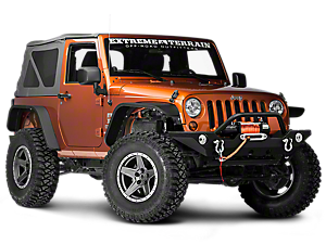
Choose your Wrangler
Select your Wrangler for a custom browsing experience
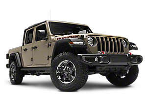
Choose your Gladiator
Select your Gladiator for a custom browsing experience
Choose your Cherokee
Select your Cherokee for a custom browsing experience
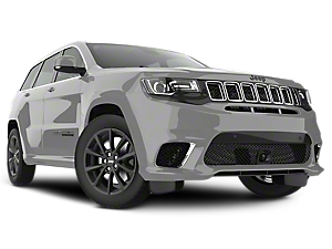
Choose your Grand Cherokee
Select your Grand Cherokee for a custom browsing experience
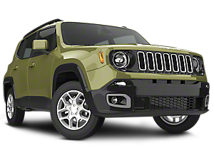
Choose your Renegade
Select your Renegade for a custom browsing experience
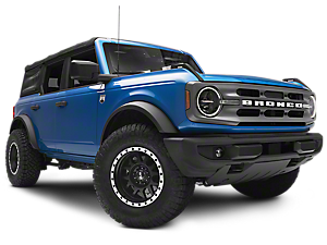
Choose your Bronco
Select your Bronco for a custom browsing experience
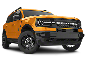
Choose your Bronco Sport
Select your Bronco Sport for a custom browsing experience
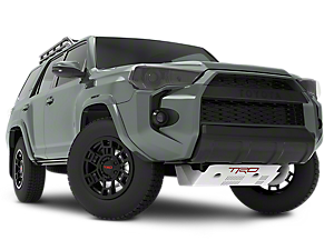
Choose your 4Runner
Select your 4Runner for a custom browsing experience
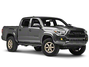
Choose your Tacoma
Select your Tacoma for a custom browsing experience
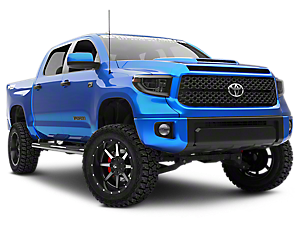
Choose your Tundra
Select your Tundra for a custom browsing experience
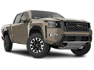
Choose your Frontier
Select your Frontier for a custom browsing experience
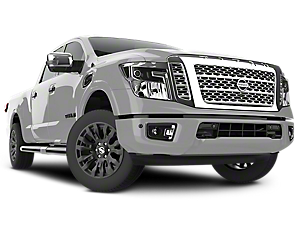
Choose your Titan
Select your Titan for a custom browsing experience
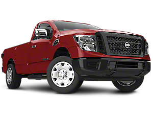
Choose your Titan XD
Select your Titan XD for a custom browsing experience
Shop our other vehicles
Chevy
GM
Modding Made Easy
-

Free Shipping on Orders Over $75
Orders over $75 ship FREE to the continental US. Nearly all orders ship out the day they're placed.
-
Unmatched Quality, Unbelievable Experience
From our award winning customer service to our vastly expanding parts catalog, ExtremeTerrain's expertise takes the hassle and stress out of modding your rig, so you can focus on your next adventure.
-
Watch Before You Wrench
From our growing collection of videos, to reviews and install guides, we have all of the resources you need to make your next project a success.